Paddling the Escalante River
Images and Experiential Ramblings
BY
Douglas Tooley
|
|
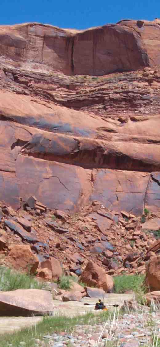
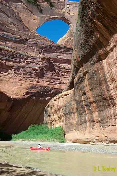
The Escalante is an exceptional river - not so much for the quality of its whitewater - but rather for the Canyon itself. In fact water is rare in this canyon -- good water years are more unusual than years when the river is not runnable at all. The Escalante is located in the heart of Southwest Canyon Country halfway between Moab and Zion. It is a tributary of the Colorado, joining that river now as an arm of Lake Powell, just upstream from the Grand Canyon. Nothing beats the Grand Canyon in terms of scale, length, and overall grandeur. However the Escalante may well be 2nd - and its intimacy and transitions, not to mention its world famous canyoneering side canyons make this an experience onto itself. Do this river if you can match the time and the water. The Escalante is not a difficult river - it is basically a 70 mile very low volume gravel bar meander between vertical slickrock walls - save for the last twenty miles which plops canyon wall boulders and slabs onto the gravel bar. Historically the river was rated class 2+ - however more recent ratings call it a 3, which I concur with. However the river does pace itself so that the physically fit class 2 paddler (with canyoneering experience?) will be ready for the class 3 by the time it arrives at the end of the trip. This site is not a guide to the
river. It is a personal description designed to convey a sense of
the experience, not provide the full details of the trip, which are
available elsewhere. The River Runners' Guide To Utah and Adjacent Areas This site is organized to be viewed in sequence, with each page roughly corresponding to a day on the river. Scroll through each page to reach the link, and enjoy. |