Tag cloud

Main

Out Through the In Door Archives

June 7, 1980

Nerd Becomes Jock

The educator Piaget talks about the abstract mind forming roughly during puberty. I started an alternative school at about that time in my life, and I have very clear memories of realizing that there was more than one way to do things in society. The school I'd left was the R.M. Nixon Elementary, after finishing 5th grade, in 1974, the year of Nixon's resignation.

But perhaps most important was the realization that one could change oneself - which I did, picking up whitewater kayaking and competing in same in the slalom classes. This is a clipping from the North Eugene High School paper by Rick Peacor.

View image

In the spring of my Junion High School year I went east to train with a former UofO physics post-grad employed by the Oakridge National Laboratories in Tennessee. Attending school in Oakridge was an experience unto itself. The city has the highest per capita of PHD's in the world. The school was certainly smart as well, but also managed to be regular winners of the State Football Championship (something my Oregon school was able to do the year after I graduated under Quarterback Gary Stott and a black running back, just about the only black in the school.) The school was big into partying as well. It definitely still had racial issues - being only about ten miles away from places where black churches had been bombed.

As a result of some of the extra credit associated with AP classes at this school I was able to graduate a semester early. I do still have some gaps in my math knowledge, advanced Trig, but the guy who spent three years in an alternative school basically doing nothing but socializing still scored a 700 on his Math SAT.

The picture was taken by my father, at a race in North Carolina Smokies hosted by the Nantahala Outdoor Center

November 4, 2007

One Step Back, Two Steps Forward

Sometimes the best way to approach your goals is to move away from them. An unseemingly large number of election items at issue Tuesday have brought this simple life rule to the forefront of my thoughts.

Moving backwards to go forwards is a life lesson taught to me through sport - and though built a bit like Seahawker Mack Strong - it's a lesson I learned through navigating the wilds of the Western U.S., not as a High School Offensive Lineman.

Proceeding blindly towards an obsessive goal can be dangerous. Even more dangerous is taking an easy road that has been put before you fraudlently.

Before my comments, a brief outdoor story, illustrating the point:

I once took a friend on one of my favorite hikes in Washington State - the Soleduck River/High Divide/Ridge Loop, just north of Mount Olympus. The day was perfect, late August with the Huckelberries at their ripest - as also was the weather.

The hike is long, about 20 miles, but it is also a loop, returning to the same spot you started. These 20 miles can be covered more easily in a day, lightly burdened, than could be covered in a weekend with full camping gear.

The pace to begin is mellow, slowly climbing through the rain forest of the Soleduck River valley, past Soleduck Falls. Only near the end of the basin do you enter the open Alpine Country - a modest cirque of heather, huckelberries, and small granite peaks. Climbing out of this basin you reach the pass, High Divide, to the Hoh river basin.

Though the climb to the pass is moderate the other side is quite dramatic, dropping thousands of feet below to the Hoh river then climbing several thousand above to the glacier covered peaks of Mount Olympus.

But this is not our route, our route is down the ridgeline - wending among rock pinnacles and cliffs as we slowly descend to our starting point - all in the glorious view of mountainous glory and riverine sublimity.

Though Huckelberries and views can do much to sustain this is a long hike, and by now all but the most enduranced of travelers will be feeling the burn. Perhaps distracted by a herd of grazing elk we chose any path that we thought was heading back down to the Soleduck Hot Springs.

But it was not descending into this watershed, it was in fact descending into the Hoh - a decision that could've proved quite problematic. Luckily, upon a bit of reflection, we discovered our error, corrected our path with only a slight detour - a worthwhile one actually - save for the legs. It was not long before we began to climb down from the ridge, steeply now, and returned to the trailhead, conveniently located next to the Soleduck Hot Springs.

For those of you so inclined, they do serve. I'd highly recommend spending the night here before driving back to home and work. My trip was the last time I smoked marijuana, an experience I'd like to do again some time. Proper time to recover, like that of an airplane pilot and alcohol, is important - something I think I learned, though not always through the easy path...

That said - observations on a few of the initiativi that are now before us.

Proposition 1, Sound Transit Two, et al:

This has been covered at length by myself and others, perhaps best on Crosscut. (The pieces by Bundy and Morrill are best - quality commenters include Piper Scott and David Sucher, and, hopefully, moi.) I won't burden my site anymore with the deserved negativity of the so-called 'business' practices of this funding proposal. (BTW, nothing wrong with the engineering, at least so far - save for poor route choice on I-90 - one of at least two very poor financial choices, the other being the Sea-Tac to Tacoma segment.)

A second vote will improve the package, just like with Sound Transit One.

R-67 - Insurance Reform:

Though the letter of this law make sense the implementation of it by the legal profession will not. Witness the heart tugging ads regarding a Puyallup Fireman, covered by the State's Workemen's Comprehensive and City of Puyallup policies, neither of which are subject to this initiatives regulations.

As for me, I trust my insurance company (and their lawyers) than I trust the trial attornies. A good place to start here would be the effective implementation of triple damages for legal practice malfeasance.

4204 - Levy vote margins for Schools

The proponents of this proposal are right. It is not fair that schools need to pass a higher threshold for passage than other financial measures. However we need to get State spending practices back in touch with reality, and a better move would be to raise the standards for all proposals to the level currently held to our schools.

I am, unfortunately, reminded of the not unrelated recent watering down of mathematics requirements in our standardized school testing program.

Lowering standards is not the way to improve our schools. Threats about the future economic success of our children, should this fail, should be legally pursued.

I-960 - Legislative Financial Accountability, by Initiative

My socially liberal politics are probably completely opposite the drafter of this proposal, Tim Eyman. However the continued lack of financial responsibility to even the most simple of legal standards is shameful.

I can't say this is the best way to do it. Like with global climate change though it is damn well time to start trying to do something. Claims of red tape are, like State Treasurer Mike Murphy, are bogus.

November 14, 2007

'Nature's Justice' edited by James O'Fallon

I'm not a William O. Douglas scholar, so I can't really compare this book to others regarding or by this influential, Washington State born, American.

However I did find this particular collection of well introduced writings both entertaining and educational. O'Fallon takes a broad selection of his writing ranging from commentaries on the fly fishing advice of Izaak Walton to Supreme Court opinions regarding civil rights in the 1960's. His stories of growing up in the NW are also worthwhile.

Douglas was not without flaws - you could say he epitomized the cliche 'Soviet State of Washington'. You could also say he was a womanizer and I'd bet drink had an influence on his life. But he was very definitely very much a man of his times and his influence is still with us today.

Mr. O'Fallon is with the University of Oregon Law School, recognized as one of the nation's best on the subject of Environmental Law. I highly recommend this book, as well as the near Seattle William O. Douglas Wilderness.

November 17, 2007

'Missouri Breaks' directed by Arthur Penn

MISSOURI BREAKS

1976

Directed by Arthur Penn

Starring Jack Nicholson and Marlon Brando

With Randy Quaid and Harry Dean Stanton


This movie has many of the elements of greatness and is a worthwhile watch. Among it's major themes is that of a young man facing the harsh realities of life on the frontier of the American West. This theme is shared with a current release, 'Into the Wild', by the director's son, providing an extra dimension to the film absent in its initial release.

Nicholson and Brando in a Western plot as complex as Eastwood's 'Unforgiven' could be a true diamond. The setting of this movie - the great plains foothills of the upper Missouri basin and the surrounding mountains of the Glacier National Park area do make a grand stage But the movie falls short, albeit not drastically.

The very young Quaid and Stanton both give performances of full depth - Nicholson and Brando are not at all bad, but perhaps just a touch comfortable in their success. Perhaps it is Penn's history in TV and the formulaic history of the Western in film, but this is a stone in the rough - needing just a bit more buffing to bring out the true shine.

The casting of an apparently jewish beauty in the romantic lead, opposite Nicholson, just seemed incongrous to me. Perhaps I am wrong, but I don't think there were all that many jews on the Western frontier, save perhaps Mel Brooks. That might be an interesting story but it isn't one explored here., The more apparent back story was that this character's father was cuckolded, perhaps most likely a jewish lawyer from Seattle? -That said, she does make a good attempt at what is apparently a losing cause.

The sound track also adds to the 'made for tv movie' feel of the flick, though if measured in that class this movie would be among the very best.

Perhaps a remake by the son, Sean, with another Vedder soundtrack? Someone will do it, sometime.

December 20, 2007

Thursday, My New Favorite Day

In the paper this Thursday (I read the Tacoma News Tribune, Carbon Footprint notwithstanding.) was an interesting article about an Italian Judge and the word 'Friday'.

Now I'm not one to question the moral authority of the Italians, but this is one to ponder, as I am doing still.

The case involved a couple naming their child, 'Friday'. (I don't recall if the article specified the sex of the child or not.) At first glance this seems perposterous, but if one bothers to read it through it becomes an interesting story.

The argument is this - 'Friday', as a name, is associated with the Dafoe novel where the native servant bears the name. As such the name would have negative connotations to it which would effect the child to the point meriting court action. Considered in the context of political correct language debates in this country the argument appears to gain merit - perhaps not so much for the actual facts of the case, but rather for the fact that the matter does merit discussion itself.

Political correctness in language is a tricky subject and restricting speech on any basis is dangerous business, no matter what the 'justification' might be. However when you are talking about a specific individual that is where the damage of language 'hits the road', so to speak. 'Talking' about such matters might seem silly, but I'm going to give this one an American 'thumbs up'. Call it an example of the law putting itself into the language in a way that is worth talking about...

Which brings us to Thursday, today.

The most distinguishing thing about the Tacoma News Tribune - in most regards a rather standard mid-sized market daily - is its Thursday 'Adventure' section. Sure the Times has more local columnists, including the outdoor oriented Ron Judd, but the mix of priorities, on this subject at least, is better at the TNT. (Which stands for Tribune and Tooley, eh?), Outdoor folks don't need a daily section like the sports jocks get, a weekly section is just right, as is the day.

I liked today's paper for another reason, but it would be a bit too circuitous to write about that here. As they say, there is always tomorrow. And as Seargeant Friday would say, "just the facts maam, just the facts".

Heyo!

December 26, 2007

Northwest Trek Animal Park

Northwest Trek Animal Park

Eatonville, Washington

Getting to NW Trek is a slog, driving down 161 via Puyallup's South Hill is like driving Aurora from Shoreline to Sea-Tac. But it is worth it, all the more so if you plan to visit the Paradise side of Rainier.

I was there for the first time Christmas Eve with 3 Nephews. This is supposedly a great time to visit as the leaves are off the trees making visibility better - antlers are also still to drop though that won't be long. New to the Park are several Moose, and according to the guide we were the first to see them - on our dusk drive, starting at 3:00.

Unlike normal zoos the park specializes in NW critters - which makes the whole native habitat attempt work very well. The park puts the most publicity on its tram, but the predator displays are just as good. There are cages, but they are very well done - we saw virtually every species, save the Foxes, including both Grizzly and Black Bear. The smart use of water and electrical barriers bring the critters closer than you would think safe, and the covers at each area make a rainy day visit quite enjoyable for an acclimatized local.

I learned a new word on this visit -'kerpuscular" (sp?) - which means an animal that is active only at dawn and dusk. The last tram of the day, 3:00, may well be the best, in that regard.

February 18, 2008

On President's Day

For your consideration, a Presidentially themed proposal - a bike trail through the McKinley and Lincoln neighborhoods of Tacoma: (The Greenbelt above I-5 near the Tacoma Dome, for you out of towners)

President's Ridge Bike Trail

Okay, so the President's name might be a touch hyperbolic - something I've been know to lean towards. It might however catch on, at least hopefully as something that will have the support of more than one neighborhood. (Hopefully also the 'non-presidential' neighborhoods aren't insulted!)

The ridge in the name is at the suggestion of Pierce County Councilmember Tim Farrell supportive of neighborhood efforts at improving the area.

'Decline of the Pacific Madrone'

Decline of the Pacific Madrone

From a conference at the Center for Urban Horticulture (UW)
Edited by A.B. Adams and Clement Hamilton

1995

Unfortunately the Center for Urban Horticulture is best known as the victim of an alleged eco-tourist attack (never rule out some smart counter-terrorism on these sorts of things). It should be best known as the agricultural extension agent for 21st century environmentalism. Their staff is very helpful on questions relating to the health of the urban environment - for everyone from the most sanguine and connected landscape professional to the lay home owner with an avocational expertise.

Like it's publisher this book may also have more presence negatively than that positively earned. It is true that Madrones have suffered some locally - but this book investigates that question to positive result. Madrones,(related to Rhododendrons) are beautiful, unique, and native can be successfully planted.

In fact it is quite possible that the sick trees seen are soley the side effect of making them visible. When a stand is revealed by the construction of a nearby road roots can be disturbed, something the trees are sensitive to (they also don't transplant well from the wild, once established). In addition the bark is sensitive to light, more so if it has grown in the shade and then is exposed. A tree that thanks to that same clearing is now on the edge of the forest may develop problems from such. The only real bad news is that the distinctive red bark is a sign of stress - it is not necessarily fatal, but too much can be a bad sign.(It shows a weaker protection against disease penetration)

Many trees can also be quite spindly, with little foliage, except at the very top. This is an effect of growing in a denser forest and the competive stress of same can lead to a less healthy tree, as it does in many species.

A little bit of spindliness can be quite attractive, like some of the trees in Seattle's Magnolia neighborhood. My personal observation is that the form of these trees is most likely a remnant of their youth, prior to the development of the boulevard. In a sunny spot and well drained soil a Madrona should thrive.

The conference that inspired this collection was brought about by the actions of the Magnolia neighborhood. I haven't been there lately, but I do recall one of the test plots, near the main Discovery Park parking lots. The success of these trees, as well as the grand old fellows (and ladies) of Magnolia Boulevard is perhaps the best testimony to the accuracy of this research and its ability to stand the tests of time.

Per the Center for Urban Horticulture the trees are available at least through these sources:


Burnt Ridge Nursery in Onalaska, WA
http://burntridgenursery.com/search/searchprods.asp
Forest Farm in Williams, OR
http://www.forestfarm.com/search/closeup.asp?PlantID=arme095
wholesale nursery Fourth Corner Nurseries in Belllingham, WA
http://www.fourthcornernurseries.com/PlantDetail.asp?Symbol=ARME

March 4, 2008

Just one more thing...

Well, it certainly looks like there are some violent wack jobs hanging on to the Earth Liberation Front movement - as evidenced by some rather spectacular fires in the SE Snohomish County community of Maltby.

The operative phrase in that sentence is 'looks like'. It is quite possible that this is just an arsonist torching unsold multi-million dollar homes (the one sold was the only one untargeted) using the ELF as scapegoat - and scoring a few political points in the process. These houses are big, that's true, but they were also showcases for environmentally friendly building processes.

The current court case regarding the accused look out for the alleged ELF bombing of the Center for Urban Horticulture, in Seattle is worthy of note. Though this particular individual is claiming innocence I do believe they have confessions, and deals, from the alleged other participants.

FWIW though I don't know the particulars of those other individuals - and targeting a bunch of Master Gardeners just seems plain weird.

Odds are definitely pointing to the ELF. Not a long shot, that. News flash to Hillary, Barack and McCain - it looks like we've got our own 'Al Qaeda' movement brewing in America, no need to import it.

April 11, 2008

Two Tibetan Stories

On the occasion of the Dalai Lama's visit to Seattle let met tell my two tibetan stories. I'm not very religious at all, though I do have some sense of faith - call me, if you will, 20% Budhist, 10% Catholic, 10% Protestant and who knows about the rest.

I had the opportunity to visit one of the last pockets of unblemished Tibetan culture - pockets of which exist in northern Nepal, near the Chinese border. I was 18, less than a year out of High School and it was definitely a formative experience. I did the Annapurna Circuit, half of which had only opened to foreigners the previous year. It's a 3 week hike around the Annapurna Massif, best examples of Tibetan villages are Manang and Pisang. That valley is awesome The floor at the lower end is ten thousand feet up and the ridge above is another 15, all in all probably 30 miles or so long, leading to an 18,000 foot pass.

It would take a feature length movie to give the experience it's full due. One interesting story - Tibetan rebels had operated out of the area with CIA funding. Nepal put a stop to it, and still keeps a small military presence in the area. I had the chance to spend an evening with the Commanding Officer in small Inn. He was probably checking me out, but it was well done. I don't remember his name, but he definitely had an influence on me with his stories.

Second story is about the Dalai Lama himself - I had the opportunity to see him in Eugene in the days before that Nepal trip. It was a date with one of my best relationships ever (in hindsight, sigh) - the crowd was probably less than 50. I do remember making eye contact with him, a strange remembrance as one passes his image in the press and films. Perhaps the best of which is Heinrich Harrer's '7 years in Tibet'.

No great conclusions, save perhaps though I do respect the Chinese history they really should step up here and do the right thing.

June 9, 2008

Postcard from Durango

I'm a bit behind on my blog thoughts - I've switched my hosting provider in the last month. I attempted to upgrade to the latest version of Movable Type. In hindsight that was a bad idea, the latest version is actually less functional than the current - being more focused on the individual user market. The transition is also not as smooth as it could be, unless has a direct knowledge of the particular XHTML/Style Sheet approach used by MT.

I've been hoping to bring my HTML skills current by diving into the open Movable Type programming approach, but haven't found the time yet. Hosting providers do provide this service, but it isn't one I can afford at this time, so back to basics, eh.

I'm writing this from the beautiful town of Durango Colorado, about as far as you can get from Seattle in the West - Geographically. Politically though it is far closer than either McCain's Arizona or Hatch's Utah. Go Figure!

Weather here is in the upper 70's, in the foothills of the Wenimuch mountains - absolutely perfect. It may well be the perfect medicine for what the doctor ordered - certainly the winter in Tacoma was a dark one for me - whatever all of those reasons might be.

-Doug

June 26, 2008

Hiking City Spirit Mountain - Animas Mountain, Durango, CO

Animas%20Mountain%20Durango.JPG

This is the view of Durango, SW Colorado (4 Corners Region) from Animas Mountain. There are many trails in the immediate area of this town, this is the closest 'real' hike. Climbing to near 8200 feet the trail provides views in all four directions. There are two trailheads for the hike, both starting in residential areas within walking distance of Downtown.

For more details see the Pixler/Peel guidebook - 'Hiking SW Colorado'. That title is a bit of a misnomer, it's actually best as a day hike guidebook for the immediate city area - as far north as Silverton and including the La Platas to the West and the Vallecito/Los Pinos drainage to the East.

Paddling Spirit City River - Animas River Days

Animas%20Rodeo.JPG

There is nothing finer than hot air and cold whitewater, and Durango has that in spades in May and August.

This is a whitewater rodeo paddler at the Animas River Days. The event is sponsored by 4 Corners River Supply, a long time business in this City. The owner, former Wildwater national team member Andy Corra, once lived in Fremont. (Funny thing, I remember being in his house, but I don't think we met!)

Animas%20Slalom.JPG

I had the opportunity to be a whitewater slalom gate judge. Here's a view from the course just before the start. Note the climbing hammock in the tree to the right. Definitely a great way to spend a few hours.

Rafting%20Animas.JPG

Nothing like jumping in feet first! Or, as the case may be, the other way around. This is a new setup for a smaller cataraft, as a two person paddle boat - looks like a great idea, but I think the final judgement may yet await.

Capping off this day was a paddlers movie festival hosted by 4 Corners - at the town art house theatre, the Abbey. 'Whitewater Gods' - hosted by the deceased filmakers father, Pete Miller of California (the death was not paddling, rather on motorcycle - however the risks maybe similar, at least when it comes to 'creekers'.) The second film, 'Hotel Charley' was also introduced by the film maker, Jesse Coombs - presumably of the Coombs paddling family.

The theatre serves alcohol, but Coors is not on tap...which doesn't mean I didn't drink a single one while here, Mary Cheney not withstanding.

June 27, 2008

Not Heaven, but Purgatory

Supposedly the Durango area ski resort, Purgatory, is the closest Colorado ski area to Texas.

This picture is from Purgatory Flats, a trail accessed immediately across from the ski area. The mountain is 'Engineer', a great late summer high altitude Colorado scramble. Though not Whistler, the ski area has an active summer program, including water slides, etc. A chairlift ride to the top is $3.00. I've no idea if pets or mountain bikes are allowed.

June 28, 2008

Dry Fork for Bike Forks

This is one of the few views from the deservedly popular Mountain bike loop including the Dry Fork trail and the penultimate section of the 459 mile Colorado Trail. It's a nine mile loop climbing 1200 feet, almost easily climbed in one direction. This trail is only about that far from town, to the west.

The view is of one of the La Plata's, a smaller 13k range marking the transition from the Rockies to the Utah Canyon Country to the West.

June 30, 2008

Pine Mesa Whitewater

This is Mesa Canyon of the Upper San Juan, below the town of Pagosa Springs. It's not a particularly difficult stretch, but at 2000 CFS it is a great play run, or for me, a whitewater open boater.

Unfortunately I had to skip running the Animas in Durango as it was too high in this great water year. I think the local word is 'carnage', which can also be fun - perhaps this old man is too proud.

July 1, 2008

First Fork/Red Creek, last, but not least

One of the downsides of a dryer climate is an increased risk of fire. This is the view from near the First Fork/Red Creek loop on Missionary Ridge. The ridge was the site of a large fire in 2002 - note also the aspen re-growth.

July 2, 2008

Leaving Durango, One Happy Dog

This is my famous companion, Zephyr. I think he's got his trail legs as much as moi. So, I guess, make that two happy dogs....

July 5, 2008

Crack Canyon of the San Rafael Swell

San%20Rafael%20Crack%20Canyon%2008%20001.jpg

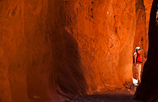
Crack canyon is an easily accessible slot in the San Rafael Swell, south of I-70, near Hanksville and the Goblin State Park (Utah). The trail does have chokestones which require some athletic mobility. They aren't overly difficult, have climbing tools in place, relatively well travelled, and with known safe exits downstream. As such this is great for an introductory challenge to this neat little niche outdoor sport.

The road is a bit rough, for a few miles, but most of the connecting roads between Hanksville and I-70 are quite good. It makes a good stopover on a scenic route - should you be so fortunate to fit it in. As always I'll leave the details to others.

san%20rafael%20crack%202.jpg

The canyon starts out relatively wide, narrowing as you progress.

san%20rafael%20crack%203.jpg

This is the first of three chokestones. I didn't go past this point as time was limited, and, I'm also a bigger guy, a risk and mobility limiting factor. I did speak with a father son pair who had been through all three. This is not a trip without risk, and if you don't feel comfortable evaluating those risks don't proceed.

July 6, 2008

Little Grand Canyon of the San Rafael River

little%20grand%20canyon%20san%20rafael%202.jpg

The San Rafael is not a big river in Utah - there are only two rivers in the entire State which are not quite small - the Colorado and it's major tributary, the Green, both originating in the Rockies. The San Rafael itself originates in the Wasatch range, home to Utah's powder snow and backdrop to Salt Lake City, at its southern end. It's season is short, but later than most Utah river due the elevation of the source.

That fact means it can possibly be quite hot - something you should be careful, especially if you wear a life jacket and/or have extra insulation as do I.

Little%20Grand%20Canyon%20San%20Rafael.jpg

The guidebook I used rates this river as 'class 1 1/2' - which I'd agree with. Do note that it is a wilderness trip and has log jams and brush hazards - a good trip for anyone who is reasonably fit, outdoor risk comfortable, and able to paddle a boat on a lake. It is 17 miles which makes it long enough for an overnight - and also adds to the risks of heat exhaustion. Personally, it reminded me of the Escalante nearer to Lake Powell, though much shorter and definitely easier.

There are at least three major side canyons. As with most Utah Canyon rivers your best source for side hike info will be one of the specialty canyoneering guidebooks for the specific area.

The southern access to this river is just across the Freeway from the BLM dirt road access to the Crack canyon slot. The takeout is a spectacular spot, and has a campground. If you wish to create the best experience for canyon neophytes definitely access this route from the north and only spoil the shuttle drivers.

I exited that way, towards Salt Lake via the Huntington drainage - a cool escape from the 100 degree desert - and what looks to be some great intermediate 3+ continous small mountain whitewater. My riverside streamsite was incredibly beautiful.

July 8, 2008

North Umpqua Area

On this trip I'd journeyed across the Desert from Southern Colorado on what felt like the hottest, and most desolate, route possible. I'd done my high school years in Eugene, just a bit to the North, so the coolness of the Mountains felt like home in more ways than one. Or, to be more specific, close to home.

I came through the Diamond Lake resort area, just north of Crater Lake. Located below the Matterhornesque Mt. Thielsen the spot is a gorgeous out of the way hide away. Like Tahoe there is a bike trail around the lake, 11 miles total, also accessible via cross country skis.

There was quite a bit of smoke in the area from some California wildfires, so no pics. I spent the night down the river a bit, one of my favorites in the State. There's no wilderness on the descent, but it is still incredibly pristine, has reliable water all summer, and captures the best of it's major riverine neighbors, the Rogue to the South and the McKenzie to the north.

I camped at one of the trailheads for the North Umpqua River Trail and did a short riverside hike. Here's some pics:

N.%20Umpqua%20Trail.jpg

N%20Umpqua%20River.jpg

This lilly looks a lot like the garden variety that I've got blooming at home as I write this, but much smaller. Nice.

Umpqua%20Lilly.jpg

July 9, 2008

Tahkenitch Beach

The Tahkenitch beach area is one of the most difficult to access on the Oregon Coast, which, in my book, makes it one of the best. It's located just north of Reedsport and the Umpqua river mouth. The area is similar to the more popular dune areas near Florence, Eugene's beach town, sans dune buggy's and crowds.

I did the 6 mile loop via Three Mile Lake, there are other options and entry points. I camped above the lake with a few of the ocean about 1/3 of a mile off, across the Dunes. Coming via the desert made the coolness a relief and pleasure. Walking near the surf near dusk was a study in the sublimity of so many near shades of gray defined most clearly at the horizon between a gray sea and a gray sky. A portion of this beach is open to vehicles, but the rather cute couple cruising by on a pair of clam digging equipped ATV's was not a distraction.

This one is worth doing again, with sun next time, for a study in contrast.

Tahkenitch%20Email.jpg


August 18, 2008

The Zen of the Water Stick - Whitewater Slalom at Beijing

Saturday Morning I stopped by Tacoma's Dragon Boat Festival, the large Asian Canoes somewhat similar to a Hawaiian Outrigger, also popular here in the Pacific NW. I believe the crowd was largely Cambodian, the kids looked like they were having a lot of fun. Mayor Baarsma spoke briefly to a sparse crowd. In the Baarsma style he gave a quick speech, and he seemed a bit uncomfortable in front of the audience.

Curiously, I mentioned my Baarsma impressions to two other people I ran into that same day, both of whom had Baarsma Dragon Boat stories. Hmmm...

More importantly though in Beijing Whitewater Canoe Slalom was being contested at the 2008 Olympics.

This is my sport, and unlike the endurance of flatwater long distance boating Whitewater Slalom is a sprint, and very much an art. The amount of power in a river is incredible and your blade is the way you interact with that energy, maintaining as much control as possible.

It has struck me that whitewater sport is something very amenable to the philosophies of various martial arts. It was an idea of mine to get to China this year and do a little bit of primary source research on the subject while attending this event. Alas, that was not be, perhaps that is an opportunity that is still open to me.

A couple of lessons from this sport towards that same end:

1. Always know where you are going on the move after your next one

2, No matter what you do, you are going to be going downstream.

Deal with it!

My particular class was Single Decked Canoe - an estoteric specialty. I was good, but certainly not of international medal caliber. My biggest distinction was being the first team member from the West Coast, ever. Personally though my training marked the transition from being the unathletic geek to being pretty buff. After all, controlling your own life is the most important thing, isn't it?

Here's the Video of the top 3 finishers in this same class, from NBC:

Beijing Whitewater C-1 Video
(approx. 15 minutes)

The American in this class was a newcomer, Benn Fraker, from Georgia, who placed sixth. Heather Corrie of America placed 8th in the women's kayak class, while the male kayaker, Scott Parsons, did not make the final.


August 25, 2008

Un 'Lockeing' Olympic Spirit

Funny thing about these just concluding Olympics - my strongest memory was actually of former Governor Gary Locke, the first Chinese American Governor in the U.S.

The coverage was local, of Locke running the torch for his 100 yards or so, in China.

He definitely had the spirit, same one he's always had. At the same time though he definitely looked like he was in need of something to do. Although I have concerns about Locke's pandering to some of the worst of the system he also left that system before (hopefully) it actually corrupted him. This stands in stark contrast to former State and Local associates Gregoire and Satterberg who started from a similar educational and intentions point and ended up being corrupted.

Is there no work for honest, powerful people in Washington State? Really, is there nothing here for him? Here's some ideas - how about putting forth an Olympics bid for Seattle - say 80% privately funded? Or perhaps as Ambassador to China, under Obama?

Even better, how about one of my pet projects - the formation of a private University to rival Stanford, Princeton, Yale or Harvard?

September 8, 2008

Sunrise@Sunrise

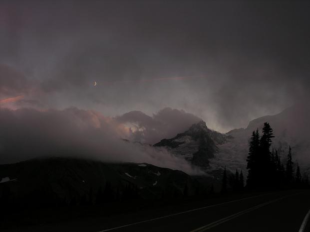
Spent the Weekend on Rainier. I'll let the pictures do the talking, save for a couple of points:

Rainier makes a great weekend trip, the loop of the Mountain is as convenient to Metropolitan Puget Sound as a Lahar is dangerous.

'Trailhead Camping' is great, though I'm not sure how accepted it is in this park. One thing for sure, it's great for catching early wildlife and missing the summer throngs at Paradise and Sunrise.


September 15, 2008

Wandering in the President's Lemon Grove

Like a wave crashing on the Southern California shore suburban America spread inland from the western US coast starting in the 1950's.

I was born in that wave, at the crest of another wave in the history of America, call it John Kennedy's Camelot, of the early 1960's. It has been said that as goes California so goes the nation, and our family was much a part of that.

As you know, southern California was once under Spainish rule, and the last remnants of that were the citrus groves of 'Orange' County and surrounding areas, just to the south of LA. This county is the conservative balance point to weat Hollywood and it's global influence. It is where John Wayne died with 50 pounds of 'stuff' in his colon.

My elementary school, in Yorba Linda, was built on the site of Richard Nixon's family Lemon Grove. The trees were gone, but the modest family house remained, housing the school's custodian.

Continue reading "Wandering in the President's Lemon Grove" »

September 23, 2008

Japanese Maples - Street Tree Experiment

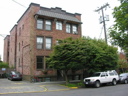
I worked as an Apartment Manager on South Capitol Hill, across the street from SU's Xavier Dorm, while completing my transfer Honor's B.A. at the UW. (In Economics).


We renovated the building off of cash flow, over four plus years, through to its sale. One of the projects was the planting of trees in front of the building. Japanese maples are common in the area, on the Seattle University Campus and in the residential neighborhood, home to respected Japanese gardeners. (King TV and KIRO radio personality Ciscoe Morris is most commonly thought of as the SU gardener, but it was the Kubota's, of SE Seattle's Kubota gardens who did this work, prior to Mr. Morris's arrival.)

Japanese Maples are not, however, on the approved list of Street Trees. I won't say I had the approval of City Arborist Jerry Clark in order to do this planting, but it was also not done without 'consultation' of this City provided expert.

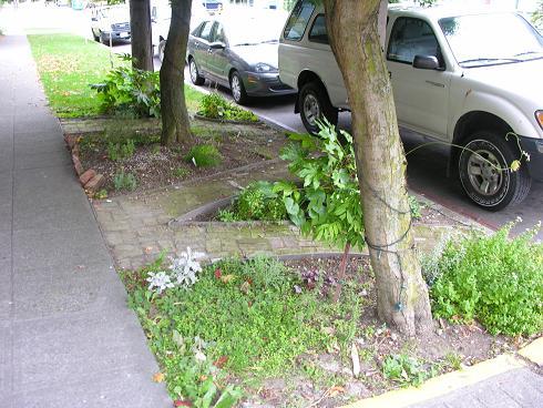
These pictures are from last week some 20 years or so after the planting - and I think we can call it a successful experiment. The trees are thriving in the harsh street environment, not interfering with power lines, nor with the sidewalk.

BTW, can't say enough good things about my employer, Weber and Associates. Mr. Weber, and company are definitely not your typical do nothing real estate speculators.

The building remains in the same ownership from those that purchased it from Mr. Weber, rents though have not remained the same. I can't remember if we were getting $275 for the 3-4 hundred square foot studios or the slightly larger one bedrooms - these days, $800 and up!

November 17, 2008

Big Falls on the Little Mashel

Falls of the Little Mashel River

This is a hidden little gem, just South of Eatonville towards Mount Rainier on the Alder Cut-off Rd. It's on the Eastern Boundary of the Pack Forest, a large operation of the University of Washington's college of Forest Resources. The Falls are described in Harvey Manning's low elevation guidebooks, but accessed from Hwy 7, some 2-3 miles away - accessed here, they are perhaps 2-3 hundred yards from the road.

There are 3 main falls, and several smaller cascades. The largest, the lowest, is 150 feet.

Access is a bit of a steep scramble, but not too bad. I'd stay off of it immediately after a rain, but give things a day or two to dry out a touch and the routes are fine, though there is a bit of log hopping and you'll use your hands a few times. During the summer months you should be able to cross the large creek safely, just above the lower falls, saving the double scramble on each side.

To park, look for the first trestle on the Elbe rail line, just outside of Eatonville. Park just before or after this bridge. Google Area Map.

If you want to hike a bit farther, check out the Pack Forest - a loop can be made up to Hugo Peak in 3 miles or so, via Road 1000 and the Reservoir trail.

Pack%20Rainier.JPG

Alternatively - you can hike the little used rail line north and downhill 2 miles to the gorge on the Big Mashel. Better, visit the falls twice, and do both!


November 24, 2008

Deliverance

Deliverance

Screenplay by James Dickie, based on his novel

Starring Jon Voight, Burt Reynolds, and Ned Beatty

1972

From the year of Nixon's re-election comes this classic outdoor flick. Burt Reynolds is at the top of his game, taking his yuppie buddies on a river trip, just before it is damned by the most recent project of the Tennessee Valley Authority (The SE US's equivalent to the BPA).

Locals aren't happy about being displaced in name of progress, but they do share a love of music. The banjo playing in this movie is incredible.


November 26, 2008

Soggy Sneakers Guide to Oregon Rivers

Soggy Sneakers Guide to Oregon Rivers

By Members of the Willamette Kayak and Canoe Club

2004 (First Edition 1980)

This book, still in print 28 years after it's initial publication, is a great example of a volunteer based organization producing a very useful tool - though it does help to understand that each seperate contributor will have his, or her, own biases. That however is good advice no matter the professional status of the contributor.

I was fortunate to have spent my high school years paddling with maybe 2/3 of the original contributors of this book - a great group of mentors. This included the natural resource folks at Oregon State University, who saw the project to completion and Gene Ice, the instigator of the project, a post-grad physics student at the University of Oregon who would later go on to win awards for the industrial applications of his particle beam research. I wrote the descriptions for 3 segments, one of which is in the current edition. This run is lower Fall Creek, very close to Eugene and just below a flood control dam - which draws down in late summer, providing a great recreational opportunity when much of everything else has dried up.

December 8, 2008

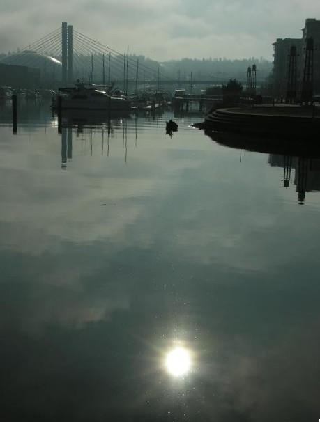
Downtown Tacoma's Thea Foss Waterway - A Study in Gray


This is the Esplanade, in progress along Downtown Tacoma's Waterfront. For orientation, I-5 is located between the Tacoma Dome and the hill in the background. I live on that hill, just back from the edge, to the right of what's visible, but still within the boundaries of the frame. This Esplanade/Trail is a work in progress, maybe half a mile at best right now. I'd definitely recommend a bit of exploration, in combination with a visit to Chihuly's Museum of Glass - or a shorter walk near the Foss Waterway Seaport, to the North.

Signs are good for this project to be completed, hopefully some day leading to within a block or two of my house, in future phases.

Click through for a couple more pics.

Continue reading " Downtown Tacoma's Thea Foss Waterway - A Study in Gray" »

April 11, 2009

Corporate Bureaucrats - An Invasive Species?

I just finished the requirements for a 200 hour program in Native Plant Restoration here in Western Washington, a great idea for a citizen based program.

As rambling as this particular brain may be I've gotten to wondering, perhaps we should be looking at corporate America - public and private, as an 'invasive' weed.

Of course this is nothing but an analogy, but do consider the similarities. Both spread easily in 'disturbed' ground, both create monocultures where diversity, by some measure, disappears. Getting rid of them both are also similar, nothing to be done but yank em out by the roots, and repeat - while replacing with some more desirable 'organisms' along the way.

Certainly, it would be great to get rid of those folks who have built their career not contributing to the ecology, but by attacking it, by whatever means - and the plants too - whether it be public 'ground' or private 'ground'.

June 19, 2009

Sound Transit and Tacoma's Dome District

Jori Adkins, Jim Merritt, and Apex Engineering have done some great professional work creating a 'post and beam' alternative to the ill-conceived Sounder 'berm' crossing of the Dome District in Tacoma and put it up on a website.

This stands in sharp contrast to the City's current position, as I hear it, that you can't use the area under the Post and Beam for anything. In addition the Sound Transit plan violates the City of Tacoma's Comprehensive Plan on both initial trail planning and the new but promising 'habitat corridor' designation which is designed to work well in denser areas.

Sound Transit does have a plan for a pedestrian connection - at 'A' Street, but this is basically a connection to nowhere, unless there is a major redesign of I-5 in this area.

Berms have construction problems as well - greater utility relocation is a very common place for costs to escalate and building close to the berm has issues with that structures 'load' profile.

Perhaps the biggest problem with the Sound Transit design is aesthetics - they are taking a rural rail design and plopping it down through the 2nd largest urban center in Western Washington. Imagine, if you will, a 20-40 foot high 'mountain' of dirt running down the middle of the street by your office - with a trash collecting fence.

The arrogance of Sound Transit in responding to this professionally prepared alternative isn't too pretty either. Not to mention also fiscally irresponsible.

July 19, 2009

The Tooley Bridge (over troubled waters?)

A new riverside trail has been built just outside of New York City on the Bronx River, through the Westchester County towns of White Plains and Scarsdale, the highlight of which is 'Tooley' Bridge near the Scarsdale Falls. A great trail guide, and story, has been created by the local newspaper.


July 24, 2009

River of Sorrows, the Rio Dolores of SW Colorado

Here's a slideshow from a solo canoe trip through the Slickrock section of the Dolores River, from earlier this spring.

This is a little known classic multi-day desert trip that now only runs for a few weeks each spring, because of an irrigation project completed in 1984. If you are in the area and it is running the river is highly recommended.

July 26, 2009

Tolmie Peak - Mount Rainier N.P.

Mowich Lake is the secret access to Mount Rainier - it is the closet access to the Mountain, though the last 17 miles are on gravel - and only another 30 from my front door! Spray Park is the popular hiking destination via the trail for most or for the cognoscenti the 'secret' Mountaineer club route. The Tolmie Peak Trail actually takes you away from the Mountain, to a perspective that is just a bit more wide angle for this massive destination.

Tolmie%20Rainier%20View.jpg

The lake in the foreground is Eunice, which looks to be a great place for a swim, including this spot:

Continue reading "Tolmie Peak - Mount Rainier N.P." »

August 8, 2009

So Cool -
Anderson Island Beach Walk

Temps around these parts are now barely breaking 70 with clouds, when so recently we broke the all time record with 104, quite the change on a usually reliable sunny 80's for July and August. As such a perfect day for a beach hike that might otherwise be done in Winter.

Anderson Island is in the South Sound, serviced by the only island ferry route **not** run by Washington State, hence making it the most quiet of all puget islands - and the most remote, having the power off for over two months this last winter due a cut cable.

Otso Point

This is Otso Point, a shy two miles from the Ferry Dock, best at lower tides if one wishes to keep the shoes, and thighs, dry.

Continue reading "So Cool -
Anderson Island Beach Walk" »

August 12, 2009

Desert Road Pics

Here's some pics from my road trip back from SW Colorado into the Western Washington 'zone' over Memorial Day. I also took the 14' Lapstrake rowboat onto Lake Powell at Page It was just for a couple of hours and no pics, hopefully a good mental warm up for a multi-week canyon sojourn - if I can handle the solo.

Continue reading "Desert Road Pics" »

September 13, 2009

9/11/2009
- Escape to Comet Falls and Van Trump Park

November 5, 2009

Transportation Planning Districts - 2009

The City of Burien, an affordable suburb south of Seattle, resoundingly rejected a Transportation Planning District (TPD) for sidewalk and bike trail improvements. TPD's are a revenue mechanism drafted by the Washington legislature last year.

This is unfortunate, but also telling. Though some might respond with a knee jerk response to those who vote against taxes, it is crucial that the community planning effort be engaging enough to sell the product of the effort, as well as produce good design based on competent engineering. In this regard it is the planning effort that failed. So, it is back to the drawing board, and rightly so.

The measure may well have also suffered from the particular form of tax used, a surcharge on vehicle licensing ($25). This particular form of taxation has been highly politicized due its role in the career of highly controversial initiative guru Tim Eyman. The drafting of this enabling legislation was done on the heels of a failed Eyman initiative on the subject of transportation. This political context may well have been the largest factor in the defeat of the measure.

Though Burien does have some expensive waterfront homes it is largely a blue collar town and it appears likely that the 'democratic' bureaucracy made errors in the community planning effort which offended the common sense of these individuals - not unlike the political dynamic that led to the election of Ronald Reagan in 1980.

February 12, 2010

Game On: Forecast - no Green, no White, but plenty of Red

The Vancouver Winter Olympics open tonight with snow and money stories, plus a smart ass red head.

Like many Western Ski areas Whistler's Intrawest development is struggling for lack of green, and proceeding through a Wall Street foreclosure, just as the games kick off. Talk about supporting the Olympic Spirit of amateur athletics!

Freestyle skiing and snowboarding are being hosted closer to Vancouver, at Cypress Mountain - where, curiously they have no snow..

Shaun White, the jaggeresque redheaded snow boarder is a good bet for plenty of US Gold, and should prove to be quite entertaining. Speculation will no doubt continue as to White's supply of green, certainly he is not hurting for the monetary kind.

FWIW, I do hear that semi-legal marijuana is openly available, and used, in Whistler. Personally I remember paddling the Class IV Capilano River **in** West Vancouver (located between Cypress Mountain and Grouse Mountain, hosting the Today show crew) high, only time I did so, with the Canadian National Whitewater Slalom Champ.

Quite memorable, that.

March 22, 2010

4 Corners Canyons and Ruins 2010

In no particular order some favorite pics from a recent trip:

May 22, 2010

Two Weeks in the Dirty Devil Canyon

The Dirty Devil River flows between Hanksville, Utah and the Colorado River, at the top of Lake Powell, what was once the start of the much missed Glen Canyon.

Some of the Dirty Devil's side canyons can be reached from the hard to reach Maze district of Canyonlands National Park. The most well known of these side canyons is Robber's Roost, a hideout for Butch Cassidy and the Wild Bunch. I spent three days in this area, the first in the following slide show.

The last side canyon in the presentation, the slot, is Happy Canyon - one of the world's best and nearly a mile long.

November 22, 2010

Eastern Oregon Outback

Ranger Shooting in Grand County, Utah

The shooting of a State Ranger in Grand County, Utah, last Friday night is a tragedy, but having just left Grand County on Wednesday let me add a bit more depth to the story.

Just the Friday night before I was camped in the Kane Creek Springs area near the San Juan County line and was mildly harassed, by a couple of 'rangers' - jurisdiction as yet unknown. It was at almost exactly ten p.m. and the first of two official vehicles made it a point of stopping on a curve at the main road with his lights pointed directly at me, just as I was exiting (somewhat awkardly, half-dressed and half-awake) to pee.

Continue reading "Ranger Shooting in Grand County, Utah" »

December 26, 2010

2010 Outdoor Highlights

2010 was a great year for the Outdoors - here's a selection of some of my best photos.

April 7, 2011

Return to Moab

I ended my outdoor year last in Moab, at the end of November. Now, it is the start of April, and I'm back.

April 22, 2011

Hart's Draw Canyon via Bobby's Hole

My first 'adventure' hike of 2011, into Hart's Draw Canyon via Bobby's Hole - between the Needles area of Canyonlands National Park and Moab, Utah. There is a very good social trail into these relatively unknown canyons - for directions see the Michael Kelsey Guidebook "Non-Technical Guide to the Colorado Plateau".

June 17, 2011

Slot Canyons Via Rowboat?

Here's some pics from my recent two week rowboat trip on Lake Powell, formerly known as the Glen Canyon of the Colorado. The Escalante Arm is the second largest tributary over the 175 river miles damned. I am a fan of mixed outdoor usage, but in this particular location one can't help but feel the loss - even if what remains still has a beauty of its own.

It has been a cold spring, so the start of the trip was delayed a bit, starting just before Memorial Day. As it was the trip was a bit too hot, but rowing first thing in the morning helped a lot, as well as avoiding the worst of the powerboaters. Wind is pretty much unavoidable in the spring, but it too is much reduced in the morning.

The last picture in the show is Bishop Canyon, a tributary of Willow Gulch. Bishop was inaccessible above the lake due driftwood and rising lake levels - and my turnaround point. I was able to hike in Davis Gulch and Fiftymile Creek.

September 19, 2011

Heaven's Gate and the Sevin Devils Range - Hell's Canyon, Idaho

P0001469.JPG

The Sevin Devils Range is the highest point above Hell's Canyon. The loop hike around the range is 30 miles, several shorter hikes are possible in the area - not to be missed is the short trail to the Heaven's Gate lookout.

Access is from a steep dirt road just south of Riggins.

October 4, 2011

Papa's Got a New Pair of Shoes

My thrift store find, a pair of Nike 'Air' high top basketball shoes passed their first test in their new occupation - 'wet' canyoneering waders. Thanks again to Phil Knight!

P0001559.JPG

Also a tip of the hat to the Emery County Road crew who paved the road here (Little WildHorse Canyon), the 'Nike' of Utah road operations!

October 11, 2011

Book Review
'Radio Shangri-La'
by Lisa Napoli (2010)

radio%20shangri-la.jpg


I was inspired to read Lisa Napoli's book 'Radio Shangri-La' having visited recently opened Tibetan areas of Nepal in 1981, as well as spending a month in the Thamel district of Kathmandu. My personal favorite book of that trip was James Joyce's 'Portrait of an Artist as a Young Man' - a decidedly different phase of life from that of the author's.

Continue reading "Book Review
'Radio Shangri-La'
by Lisa Napoli (2010)" »

April 2, 2012

The Ten Commandments of Little Death Hollow

Little Death Hollow, Utah
(Little Death Hollow is a long side canyon of the Escalante River that builds slowly to superb narrows and a heavenly, nearly two mile long, slot section near its mouth. The Escalante region of southern Utah was the last to be mapped in the lower 48 States and this canyon is about as far as you can get from regular highways in a two wheel drive vehicle in the United States - in dry conditions!)

1.

I am a Jealous God and you shall put no other Canyon before Little Death Hollow, my home. You shall not say my name for any bad purpose or to any bad person. I am male, but my home is female. If you had needed climbing ropes to access me I would have given you the glands of a spider. I am here now, but I may leave at any time, especially after a flood.

Continue reading "The Ten Commandments of Little Death Hollow" »

April 30, 2012

Rocky Mountain Roundtable, 2012

Utah Governor Gary Herbert hosted a 'Rocky Mountain Roundtable' with Governor Otter of Idaho and Mead of Wyoming, all Republicans, last Friday April 27. Designed to loosely build political support for Utah challenges of Federal regulations and land ownership the event was more of an extended free form press conference than anything, and in that, it succeeded.

Personally, I think there is a non-partisan balance point on Western Federal land issues, but it will be difficult to reach.

June 29, 2012

Puma Castle (Aztec Arches)

New Mexico Natural Arch NM-62

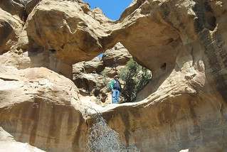
Puma Castle is a collection of 7-8 small-medium arches and one of the best, and easiest to find, destinations of the 'Aztec Arches', near Aztec, New Mexico. This particular destination was a minor discovery of mine from the winter of 2011/12, following up on the cataloging work of 'Arch Larry' - whose photo, and link, is above.

A SW Conservation Corps crew was doing habitat restoration work in the area while I was there and checked out the location on my suggestion - they liked it - and reported seeing cougar tracks on the routes through the two adjacent small canyon alcoves. They had seen the cougar itself while working, and so dubbing the area 'Puma Castle' seemed appropriate.

The area is (relatively) easy to find from NM 173, the State Highway between Aztec and the San Juan River/Navajo Lake. At Milepost 15 turn north on County Road 4600 into Pump Canyon. CR 4600 veers east up a side canyon, the arches are 7 miles up Pump, the main canyon, and are best accessed just after you cross the wash via a pipeline right of way.

There is a good parking spot at the small gravel pit used to construct the levee across the wash, but it is, at this time, a bit brushy. The largest of the Arches is visible from the main road. It is less than half a mile south (downstream) to the area. I cairned two separate routes into the two separate 'wings' of the 'Castle' from the pipeline.

The most famous of the other Aztec Arches is the Cox Canyon Arch, near Hwy 550 between Durango and Aztec. The best index of the entire area can be found here: http://www.fourcornersgeotourism.com/content_detail.php?uid=fca06D8F6C6D2A2E344A

October 29, 2012

Indian Caves At Cox Arch (Aztec Arches) BETA

The Cox Canyon Arch is the best, and most popular, of the so-called 'Aztec Arches of NW New Mexico, the 'Indian Caves' are a suggested addition when visiting this area.

IMG_0905.JPG

The two nearby caves are not commonly known and for the most difficult to find I've cairned a route along the rim-rock from just below the Cox Arch, to the South. There is also a second, small, arch on the canyon rim above this cave, visible from the wash below after an easy climb down from the rim-rock ledge.

Continue reading "Indian Caves At Cox Arch (Aztec Arches) BETA" »

November 3, 2012

Canyons of the Ancients
'P' Road Access Hikes
Burro Canyon & Slot BETA

IBurro Canyon Slot Entrance
(The entrance to the Burro Canyon Slot from the end of the access route.)

This is another Beta hiking route I've discovered in the Four Corners area, this one in the Clinton era Canyon of the Ancients National Monument. Recreational use in this area is, unfortunately, sensitive due both archaeological protection and divisive conflicts with private land in-holders.

I've personally never had any problems in the area, save for the misleading maps that exclude fuly legal roads while also asserting that anything **not** on the map is not legal. I've been informed by the folks at nearby Hovenweep that this is not the case, the only illegal roads are now marked as such. This does make sense, if you think about it, and the area is also lightly patrolled. This hike is completely legal and does not cross private property, but can be used to access the middle reaches of Yellow Jacket Creek and the bottom of Sandstone Creek. As always, be respectful of both private property and any ruins you might discover - and, hopefully, we can help to build a great recreational future for this unique area, best for a Fall-Spring hikes.

Continue reading "Canyons of the Ancients
'P' Road Access Hikes
Burro Canyon & Slot BETA" »

November 24, 2012

Durango Spins
Lost Hermosa Trail

Hermosa Creek in Late November, 2012

I've been looking for a route down to Hermosa Creek, just outside of Durango, for at least a couple of years, and, finally I've found it - literally almost right in front of my nose.

The Hermosa Campground is the closest, formal, legal campground to Durango, as well as a very popular multiple use trail head into a very large drainage - but I was looking just for quick access to the creek.

Continue reading "Durango Spins
Lost Hermosa Trail" »

March 11, 2013

MOTHERF#@%&R MOUNTAIN

Okay, in the winter this really is not a super tough climb - but given I'm knocking on 50 years of age, and well past 350 pounds in weight I ask you to pander to my delusions of toughness.

Regardless, this is a classic hike, especially in the Winter, the only sane time to visit this furnace of a biome. It climbs 3200 odd feed over 5.5 miles, one way. Unfortunately, the trip is also a good example of the failures of Federal Public Land Management so much in the news these days.

Yeah, there is a great trail head, even a bit overbuilt with railing and concrete parking blocks - but it is pretty much hidden - as sort of a private reserve only for the friends of the rangers. There is basically no signage out on Hwy 160 and what signage that is there is misleading. There are detailed interpretative displays, but none that give credit to the miners that built the trail and what mention of them is disrespectful of their entrepreneurial spirit, not to mention damn hard work.

March 18, 2013

Spring, When a Young Man, or Woman, Starts Thinking of Whitewater

IMG_1254.JPG

This is the San Juan River, at Mexican Hat, frozen, January 2013 - a reminder of the potential dangers of spring and early summer whitewater. For what it is worth, the San Juan is normally a great bet for for early and late season paddling.

March 27, 2013

Aztec Arches
The Eight Trails of Octopus Arch, Trail #1

IMG_0979.JPG

This is a work in progress in the Aztec Arches area of northern New Mexico, just south of Durango, Colorado. My Indian Caves trail is the first of these. Both of these trails are of more regional interest as opposed to the internationally known spans of Natural Bridges or Arches national monuments.

These trails do make an important point about BLM land use which appears ignorant of the variety of quality on their public properties - all too often the property is managed exclusively for resource extraction or over-protective wilderness, when much of their property would be managed with a mix of these goals, like the National Wild, Scenic, and Recreational river program.

IMG_1880.JPG

Follow the jump for a description and a few more pictures.

Continue reading "Aztec Arches
The Eight Trails of Octopus Arch, Trail #1" »

April 10, 2013

More Crazy Mothers

Disclaimer: I have no affiliation with these guys, save a respect for their chops, and 'safety' routines.

April 22, 2013

ON THE ROAD WEATHER REPORT: Moab, Utah

Breaking from a week plus of frequent rain, a glorious sunset over the slick-rock, transitioning to a waxing crescent moon peeking silver through sublime cumulus over glimmering pale Navajo sandstone.

Local conditions at the Behind the Rocks area just south of Moab: predominately motorized use, though mountain bikers and hikers are still present. Thanks to the addition of designated campsites on Utah State land chalk this area as a victory for the off-road crowd, but one also still suitable for non-motorized use, especially mid-week or off-peak. Some divisive 'redneck' attitudes were present among these users, but no worse than I've witnessed from mountain bikers, as of late. Sub-surface passive aggressiveness present, but was either challenge-able through conversation and/or other members of the party.

In the growing, popular Moab this is an area to focus more intensive use upon - improving some of the main access roads which would make hiking in the adjoining areas easier, likely also is additional space for more motorcycle/ATV/Jeep Trails. All in all has the potential to be a first class example of multiple use management.

Also, the near term forecast for wildflowers is excellent.

IMG_2015.JPG

A Tip of the Hat to Timothy DeChristopher

Congratulations to Utah Gas Lease activist Timothy DeChristopher on his release from Federal Prison, and on the documentary about the Story - including the jury precluded facts that the sale was in fact illegal AND that supporters of his actually came up with the money to fulfill the financial obligation. Below is the Amy Goodman interview on Democracy Now.

December 16, 2013

Why has Bodhi Dharma Left for the East?

Why has Bodhi Dharma Left for the East?

A Korean Zen masterwork by Bae Yong-kyun.

1989

May 5, 2015

Visiting the Dinetah, the Navajo Homeland

IMG_9407.JPG

Largo (Canyon) School Ruin Looking North

Dine' is Navajo for 'the people' and the Dinetah is where the tribe has its origins. The Navajo, as a 'formal' tribe, is historically recent coming together in the aftermath of the Pueblo revolt at the end of the 17th Century SouthEast of what is today Farmington, New Mexico. This history is fascinating, though not fully documented.

The 'pueblitos' of this area were built largely for defensive purposes and it is believed that they were for defense from raiding Utes coming from the North, not retaliatory Spaniards coming from Santa Fe further SouthEast.

This is predominately oil and gas land which means plenty of roads, but all of these sites would be difficult to visit under wet conditions. For more info see the BLM Website.

IMG_9323.JPG

'44' Panel in Crow Canyon

August 21, 2018

CRAZY TOWN

Jonathan Thompson, arguably the most prominent Journalist in SW Colorado, recently visited my current home town, Telluride. At 8750', Telluride is most definitely a hypoxia suffering 'crazy town'.

This particular short piece, originally published in the High Country News in February of 2015, is my favorite of his. At the time of this classic Thompson was based in Silverton, Colorado, his 'crazy town'.

This is not just fun and games, in this related longer feature piece Thompson analyzes the link between altitude and suicide.

https://www.hcn.org/articles/is-altitude-causing-suicide-in-the-west

Crazy Town

Jonathan Thompson

February 16, 2015

Recent research suggests that living at high altitude can affect brain chemistry in such a way as to induce either euphoria or depression. Lack of oxygen to the brain, or hypoxia, might explain both your “Rocky Mountain High” and the Interior West’s high rate of suicide.

Continue reading "CRAZY TOWN" »

Tag cloud

Archives

September 2018

Sun Mon Tue Wed Thu Fri Sat
            1
2 3 4 5 6 7 8
9 10 11 12 13 14 15
16 17 18 19 20 21 22
23 24 25 26 27 28 29
30            
Powered by Movable Type 3.35
Hosted by LivingDot
AddThis Social Bookmark Button
Add to Technorati Favorites